
ፋይል:France location map-Regions-2015.svg

Size of this PNG preview of this SVG file: 624 × 600 ፒክስላት. ካልኦት ንጹርነታት፦ 250 × 240 ፒክስላት | 499 × 480 ፒክስላት | 799 × 768 ፒክስላት | 1,066 × 1,024 ፒክስላት | 2,131 × 2,048 ፒክስላት | 2,000 × 1,922 ፒክስላት።
ናይ መጀመርታ ፋይል (ፋይል SVG፣ ብሽም 2,000 × 1,922 ፒክስላት፣ መጠን ፋይል፦ 519 ኪ.ባ.)
መጠቓለሊ
| Camera location | | View this and other nearby images on: OpenStreetMap |
|---|
| መግለጺ |
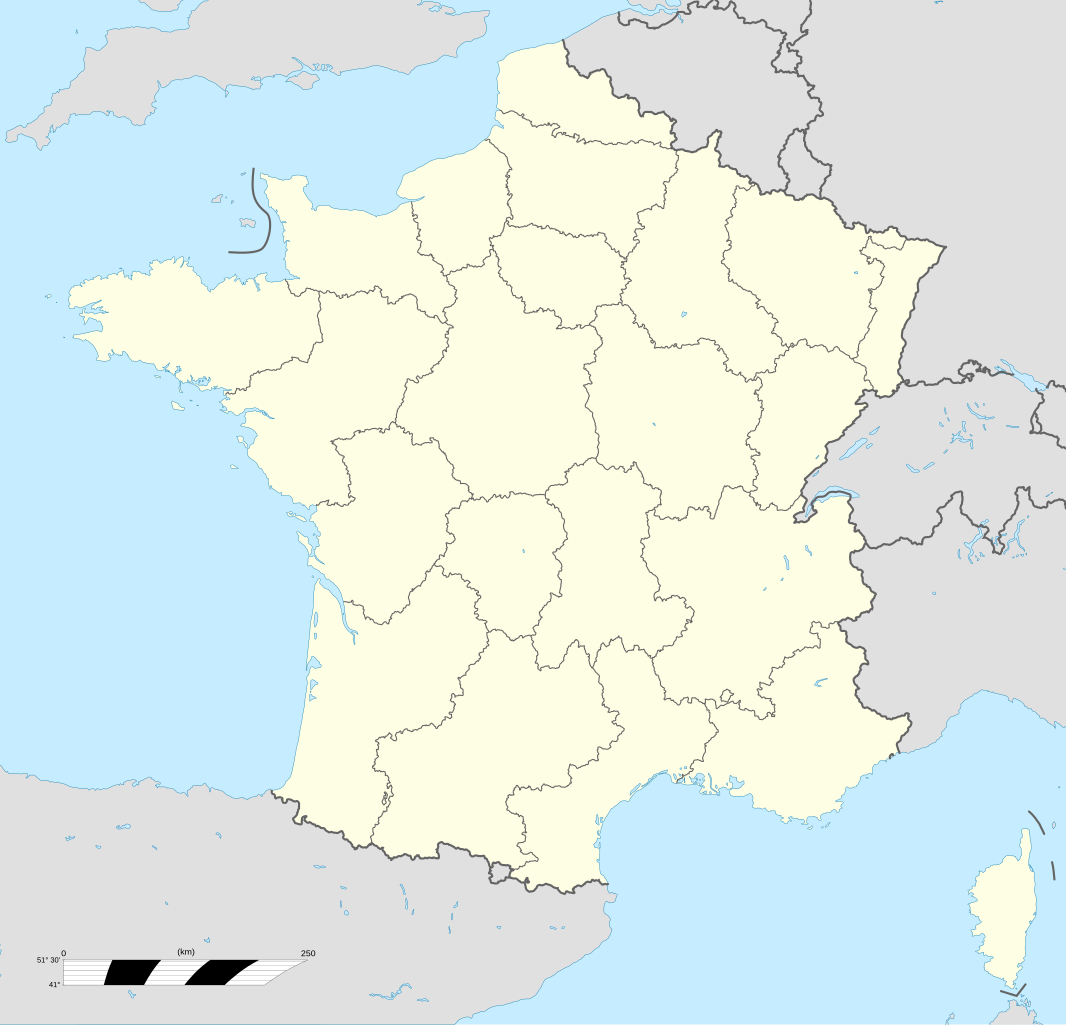
English: Blank administrative map of France for geo-location purpose, with regions.
Approximate scale : 1:3 000 000 Français : Carte administrative vierge de la France destinée à la géolocalisation, avec régions.
Échelle approximative : 1:3 000 000 Projection équirectangulaire, données WGS84
Limites géographiques de la carte :
|
||
| ዕለት | |||
| ምንጪ |
ናይ ባዕሉ ስራሕ
|
||
| ደራሲ | Eric Gaba (Sting - Sting) | ||
| ፍቓድ (Reusing this file) |
|
||
| Other versions |
Derivative works of this file: France Large South West localisation map.svg
|
||
| SVG genesis |


.svg)
ፍቓድ
I, the copyright holder of this work, hereby publish it under the following licenses:

|
Permission is granted to copy, distribute and/or modify this document under the terms of the GNU Free Documentation License, Version 1.2 or any later version published by the Free Software Foundation; with no Invariant Sections, no Front-Cover Texts, and no Back-Cover Texts. A copy of the license is included in the section entitled GNU Free Documentation License. |
This file is licensed under the Creative Commons Attribution-Share Alike 4.0 International, 3.0 Unported, 2.5 Generic, 2.0 Generic and 1.0 Generic license.
- You are free:
- to share – to copy, distribute and transmit the work
- to remix – to adapt the work
- Under the following conditions:
- ኣፍልጦ – You must give appropriate credit, provide a link to the license, and indicate if changes were made. You may do so in any reasonable manner, but not in any way that suggests the licensor endorses you or your use.
- share alike – If you remix, transform, or build upon the material, you must distribute your contributions under the same or compatible license as the original.
You may select the license of your choice.
ታሪኽ ፋይል
Click on a date/time to view the file as it appeared at that time.
| ዕለትን ሰዓትን | ድንኪ | ዓቐናት | ተጠቃሚ | ርእይቶ | |
|---|---|---|---|---|---|
| እዋናዊ | 14:05, 19 ጥቅምቲ 2017 | | 2,000 × 1,922 (519 ኪ.ባ.) | Sting | No borders over the Lake of Constance |
| 12:31, 2 ጥቅምቲ 2012 |  | 2,000 × 1,922 (521 ኪ.ባ.) | Palosirkka | Reverted to version as of 13:21, 7 November 2008 Location maps must remain very accurate | |
| 09:58, 2 ጥቅምቲ 2012 |  | 2,000 × 1,922 (206 ኪ.ባ.) | Palosirkka | Scrubbed with http://codedread.com/scour/ | |
| 13:21, 7 ሕዳር 2008 |  | 2,000 × 1,922 (521 ኪ.ባ.) | Sting | + boundary for Channel Islands | |
| 16:33, 23 ነሓሰ 2008 |  | 2,000 × 1,922 (519 ኪ.ባ.) | Sting | Larger strokes for boundaries | |
| 17:43, 25 ሓምለ 2008 |  | 2,000 × 1,922 (519 ኪ.ባ.) | Sting | Variable scale | |
| 14:34, 25 ሓምለ 2008 |  | 2,000 × 1,922 (522 ኪ.ባ.) | Sting | Other countries' color ; - border | |
| 20:22, 4 ሓምለ 2008 |  | 2,000 × 1,922 (522 ኪ.ባ.) | Sting | == Summary == {{Location|46|15|00|N|02|06|00|E|scale:10000000}} <br/> {{Information |Description={{en|Blank administrative map of France for geo-location purpose, with regions.<br/>Approximate scale : 1:3,000,000}} {{fr|Carte administrative |
ኣጠቓቕማ ፋይል
እዛ ትስዕብ ገጽ ነዚ ፋይል እዚ ትጥቀመሉ፦
ዓለማዊ ኣጠቓቕማ ፋይል
The following other wikis use this file:
- ኣጠቓቕማ ኣብ ast.wikipedia.org
- ኣጠቓቕማ ኣብ de.wikipedia.org
- ኣጠቓቕማ ኣብ el.wikipedia.org
- ኣጠቓቕማ ኣብ es.wikipedia.org
- ኣጠቓቕማ ኣብ fr.wikipedia.org
- Catégorie:Géographie de la France par région
- Catégorie:Histoire de France par région
- Discussion Wikipédia:Atelier graphique/Cartes/Archives 2005 2008
- Wikipédia:Atelier graphique/Cartes/Archives/janvier 2010
- Wikipédia:Atelier modèle de géolocalisation/Archives/2008
- Utilisateur:Newnewlaw/Portail:Portail des portails de la France
- Utilisateur:Newnewlaw/Portail:Portail des portails de la France/Carte des portails des régions/1982-2016
- ኣጠቓቕማ ኣብ gl.wikipedia.org
- ኣጠቓቕማ ኣብ he.wikivoyage.org
- ኣጠቓቕማ ኣብ hu.wikipedia.org
- ኣጠቓቕማ ኣብ hu.wiktionary.org
- ኣጠቓቕማ ኣብ lv.wikipedia.org
- ኣጠቓቕማ ኣብ mn.wikipedia.org
- ኣጠቓቕማ ኣብ pt.wikipedia.org
View more global usage of this file.